Township Council recognizes the the iconic passion for Muskoka Lakes, in particular the environment, culture and lifestyle. Council is committed to the protection and sustainable development of Muskoka Lakes.
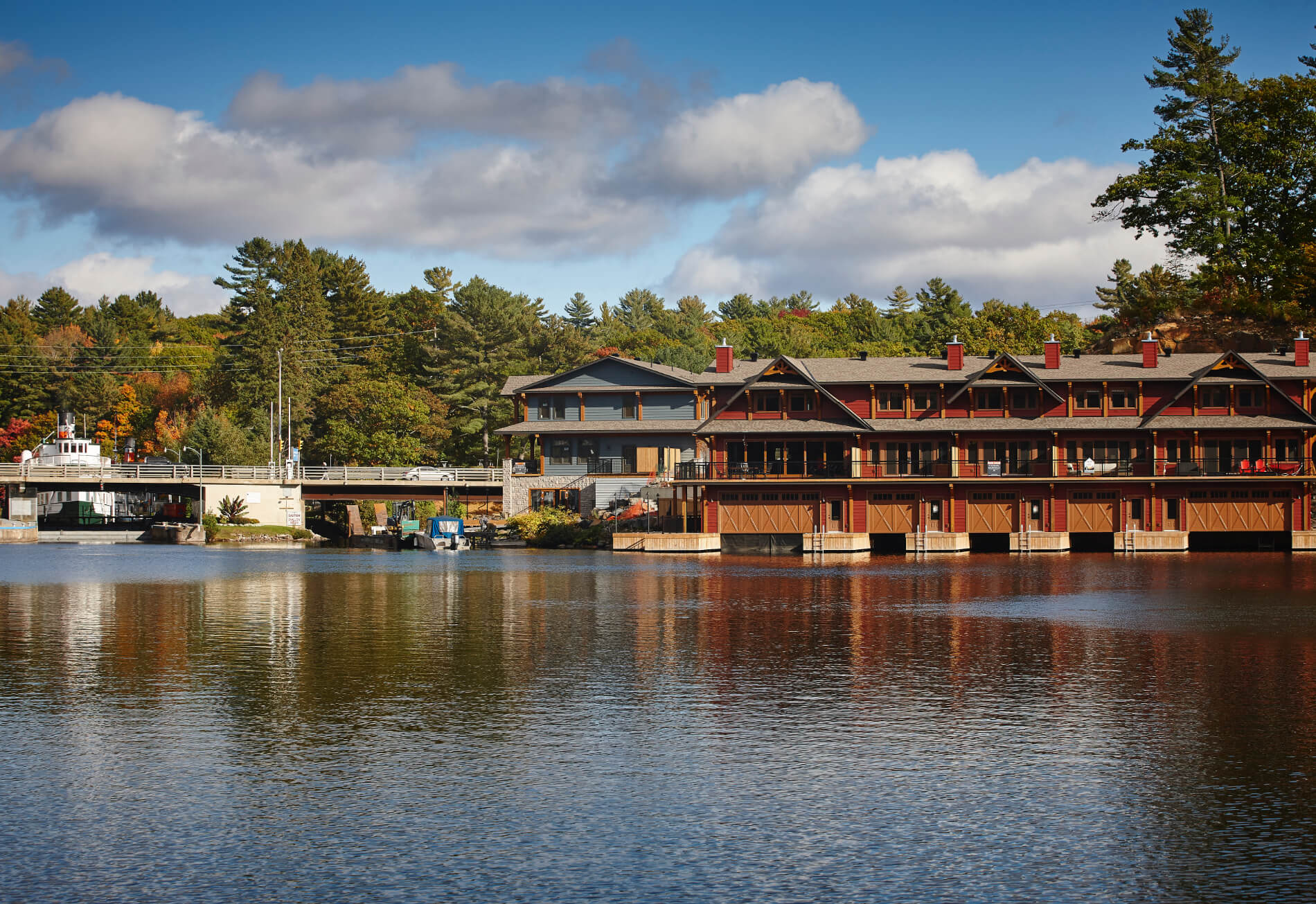
Water Levels in Muskoka Lakes
With its head waters in Algonquin Park, the Muskoka River Watershed stretches over 5,100 square kilometres and consists of 15 sub-watersheds that ultimately outlet into Georgian Bay. Water levels within large watersheds like the Muskoka River are impacted by a significant number of variables which can fluctuate dramatically throughout the year.
Local and seasonal residents continue to have concerns over water quantity management and the effects of flooding in the Township of Muskoka Lakes. The Township endeavors to keep the public informed about the state of water levels and to advocate for changes to mitigate the potential for flooding. Below is a collection of information relevant to the issues.
| Managing Water Levels in the Township |
|
Water levels in the lakes and rivers that make up the Muskoka River Watershed are controlled by a series of 42 control dams and spill structures. Of these structures, 11 are associated with power generating facilities, 29 are owned and operated by the Ontario Ministry of Natural Resources and Forestry (MNRF), one is owned by the District of Muskoka and one is owned and operated by the Township. Water levels of the lakes within the Township of Muskoka Lakes are controlled by the dams in Port Carling and Bala. The levels are managed through manipulation of the stop logs in the dams in order to achieve conditions in accordance with the Muskoka River Watershed Management Plan. The structures are managed in order to achieve power generation, fish habitat, and recreational objectives throughout the watershed. The MNRF is responsible for all operational decisions with respect to the dams. The MNRF attempts to accommodate the additional water from snow melt every spring by drawing down the water levels to provide for the additional volume. It is important to note that there is a limited ability to draw down the lakes and that the dams have a fixed capacity to pass water. The dams are not flood control structures. The MNRF monitors watershed conditions throughout the Province and issues advisories and warnings as conditions change. For information on watershed conditions, see the Surface Water Monitoring Centre or the new Floodline and Lidar Mapping 2.0 app which contains Hydrographs that show the current water elevation of seven lakes going back to 2006 as it relates to the MRWMP Operating Zones with the Target Operating Level line, Static Flood Elevation line and the Daily Water Level values updated automatically every day. |
| Township Advocacy |
|
The Township does not have any operational control over the water levels in the lakes. The Township monitors conditions (as described below) and uses the information to guide its response to the prevailing conditions. Since the flood in 2019, the Township of Muskoka Lakes has been active in advocating for change to the MRWMP and for assistance in the development and implementation of mitigating strategies at the provincial level. Since that time the following presentations have been made to the province:
Advocacy remains one of the Townships key tools to affect change through its participation in groups such as the Muskoka Watershed Council and Muskoka River Watershed Communications Committee. |
| Monitoring Conditions |
|
The Township monitors water levels in Lakes Joseph/Rosseau, Lake Muskoka and the Moon River during the lead up to and through the spring freshet period. Information is obtained from a variety of sources including: Environment Canada, Ontario Ministry of Natural Resources and Forestry, Ontario Ministry of the Environment, Conservation and Parks, and the District of Muskoka. The sources below provide data covering the primary variables affecting water levels including current snowpack conditions, current water levels and anticipated weather conditions. The information is secured through a number of websites, and will be updated as it becomes available.
The Federal Government has infrastructure on Lake Muskoka at Beaumaris and Bala Bay, and at the locks in Port Carling in order to measure water levels in real time. This data can be found at the links below:
The information is disseminated to Township Council and Township Operations Staff on a weekly or more frequent basis as necessary. Operational responses include:
Hydrologic modelling of the lakes and rivers supplemented with actual measurements from the 2019 flooding was completed by the District of Muskoka in 2020 to identify flood prone areas. Those interested may consult the Muskoka GeoHub web mapping sites new Floodline and Lidar Mapping 2.0 app which shows the location of where flooding is expected during the worst flooding events in standard 2D and 3D map views. This map includes a Dashboard showing the structures that are at risk and the most recent addition are the new Hydrographs which show the current water elevation of seven lakes going back to 2006 as it relates to the MRWMP Operating Zones with the Target Operating Level line, Static Flood Elevation line and the Daily Water Level values updated automatically every day. |
| Integrated Watershed Management |
|
In response to the 2019 flooding, the Ministry of the Environment, Conservation and Parks (MECP) created the Muskoka Watershed Advisory Group (MWAG) to provide advice regarding priority watershed management issues. MWAG provided recommendations for projects across three key themes:
After careful review and consideration of the Muskoka Watershed Advisory Group's recommendations and advice, in April 2021, the Province announced an initial investment of over $4 million to fund several projects aimed at further examining the existing conditions in the watershed and exploring ways to reduce the impacts of flooding and to address the health of the Muskoka River Watershed. The District of Muskoka is leading the majority of these projects, in partnership with the Muskoka Watershed Council. The District's 12 projects are divided into three phases. Please follow the following links to view the pages for these three phases: For more information, visit the Integrated Watershed Management initiative including the Technical Projects. |
| Stay Informed in an Emergency |
|
In times of crisis it is important to have access to trusted, timely and accurate information to ensure the safety of our community. In response to this need, the Muskoka Emergency Response Committee (MERC) has chosen Should water levels become a matter of concern, the Township of Muskoka Lakes will be communicating via our emergency notification app, Voyent Alert!. By downloading the Voyent Alert! app and registering, residents and visitors can select to receive notifications from a wide variety of communication channels including: mobile apps, text/SMS alerting, email or voice calling. The system will also allow you to create and track multiple locations such as “Kid's School”, “Work”, “Cottage” or “Mom’s House”. Any event or communication related to your tracked locations will be forwarded to you along your preferred communication channel(s). Smart alerting capabilities ensure that you will only get notified when a communication is relevant to you or one of the locations you are tracking. |
| Key Contacts |
|
For further information regarding water levels please contact the Ministry of Natural Resources and Forestry:
For further information relating to integrated watershed management and local initiatives please visit the District of Muskoka’s EnviroHub website or call 705-645-2100. |
Water Testing
Municipal Water and Sewer Services |
| If your residence uses municipal water and sewer services, the District of Muskoka is responsible for monitoring water quality. Water testing is performed regularly by an accredited private laboratory, as required by law. For more information on water quality and water testing, contact the District of Muskoka Engineering and Public Works Department at 705-645-6764. |
Private Wells and Septic Systems |
Your residence may be designed to draw water from other sources such as:
The Simcoe Muskoka District Health Unit offers water testing kits for private wells. Water testing kits are available for pick up at the municipal office during regular office hours. You must return water samples to the Simcoe Muskoka District Health Unit during designated hours. For further information, please contact the Simcoe Muskoka District Health Unit at 705-721-7520. They can answer questions related to:
|
District of Muskoka Environment and Natural Resources
Stewardship of the environment and quality of life are key aspects of many of the District Municipality of Muskoka's (District's) Services and Programs, and are reflected in the District's Strategic Priorities and Muskoka Official Plan.
Lake System Health |
| The District has a comprehensive Lake System Health program to protect our important water resources |
Muskoka Water Strategy |
| The District Municipality of Muskoka (District) spearheads the Muskoka Water Strategy, which collaborates with the Muskoka Watershed Council and wide variety of stakeholders to protect Muskoka's water resources. |
Muskoka Water Web |
| Water is a critical component of Muskoka's lifestyle and economy. There are over 680 lakes in Muskoka greater than eight hectares in size. The Muskoka Water Web was developed by the District Municipality of Muskoka to provide a portal to information about Muskoka's most cherished resource - water.
Visit the Muskoka Water Web to find water quality monitoring data, shoreline survey maps, stewardship information, and more! |
Muskoka Watershed Council |
| The Muskoka Watershed Council is a volunteer organization supported by the District and the Muskoka community. The Muskoka Watershed Council is not a regulatory or enforcement agency. Instead, it provides information to decision-makers, managers and the general public on ways to protect and restore the resources of our watersheds. |
Gypsy Moths
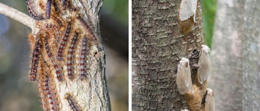
Gypsy moths are destructive pests. They get their name from their ability to travel by attaching to various objects. They appear in late July or August. Males are greyish brown and can fly and survive about one week, mating with several different females. Females are larger and whitish with darker zigzag marks. The female cannot fly and dies shortly after laying her eggs.
Gypsy moth caterpillars (larvae) change looks as they grow. Young caterpillars are black or brown and about .6 cm (.24 inches) in length. As they grow, bumps develop along their backs with coarse black hairs. The caterpillar is easily recognizable in the later part of this stage: charcoal grey with a double row of five blue and six red dots on its back. Feeding ends by early July, and mature caterpillars can be as long as 6.35 cm (2.5 inches).
Should I be concerned? |
|
Gypsy moths are a concern because the larvae feed voraciously, mostly on the leaves of deciduous (leafy) trees, but also on some conifers (evergreens). During the larval stage, a single gypsy moth caterpillar can eat an average of one square metre of leaves. Leaves play a major role in food production for trees, converting light into food by photosynthesis. Reducing the leaf surface available to capture sunlight causes a loss in food production. Deciduous trees can sometimes produce a second crop of leaves, but after repeated defoliation, trees may die or become so weakened that they are vulnerable to secondary infestations. Evergreens may die after only one defoliation. The gypsy moth has been found on approximately 500 species of trees. They prefer broad-leaved trees, mainly red and white oak, poplar, and white birch. The destruction of oaks affects forest wildlife, especially deer that depend on oak acorns for part of their diet. The acorns provide nutrition needed to survive harsh winter conditions. The discovery of the Asian gypsy moth strain in Canada has raised new concerns. The Asian gypsy moth prefers coniferous trees, is better adapted to colder climates, and the female is able to fly. These traits make the Asian gypsy moth a serious threat to Canadian forests. |
How do I know if I have a problem? |
|
The gypsy moth hibernates in egg masses that are covered with tan or buff-coloured hairs, and may be found on tree trunks or bark, outdoor furniture, or the sides of buildings. The egg masses are about the size of a loonie, and may contain from 100 to 1,000 eggs. You can tell how bad the infestation is by the size of the egg mass. When populations are on the decline, egg masses tend to be smaller, about the size of a dime. Larger egg masses are a sign of stable or growing populations. The eggs hatch into caterpillars when tree buds begin to open. This stage, lasting up to seven weeks, is when the insect feeds, so it is important to control gypsy moth infestations early in the growing season. |
How can I get rid of gypsy moths? |
Egg massesGypsy moths spread easily, as the young larvae can be carried by wind currents for a distance of up to one kilometre. More commonly, however, they hitch a ride (mainly egg masses) on objects like vehicles, tents, trailers, and lawn chairs to infest new areas. Vacationers, especially campers, should be aware of this and should check their equipment before moving on. It is important to be thorough when looking for egg masses as they can be difficult to locate. Common hiding places include:
When an egg mass is found, it should be scraped off with a knife and dropped into a bucket filled with hot water and household bleach or ammonia. Remove picnic tables, swing sets, and lawn furniture from around the bases of trees, because these objects provide the insects with protection from the heat of the sun. CaterpillarsCaterpillars and pupae can be handpicked and crushed. The long hairs of the caterpillar can cause skin irritation or allergic reactions in some people. To be safe, wear gloves when handling them. Caterpillars can be successfully trapped. To make a trap, wrap a 45-cm (roughly 17-inch) wide strip of burlap around the tree trunk at chest height. Tie a string around the centre of the burlap and fold the upper portion down to form a skirt, with the string acting as a belt. The caterpillars will crawl under the burlap to escape the sun and become trapped. Later in the day, lift the burlap. Pick off the caterpillars and dispose of them. Contact a professionalConsult an arborist for treatment options or contact your local garden supply store for the availability of materials. |
Additional resources |
Contact Us

 Subscribe to this Page